

“Senior Japanese naval officers wondered how U.S. aircrews could always find their carriers.”
By Marc Liebman
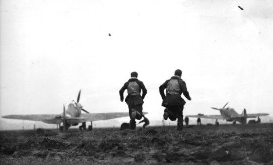
HISTORIES OF THE Pacific War often focus on carrier-based aircraft flying strikes against enemy-held islands or ships many hundreds of miles away. Yet little do these accounts cover the most difficult challenge of naval aviation of the era: Finding a carrier after returning from a mission, often when low on fuel.
Navigation, when flying over water out of sight of land, is hardly a small task. There are no visual clues as to one’s location, and ditching is the alternative to landing on the carrier. Assuming the crew survived an emergency water landing and managed to get into their raft, then what?
As someone who flew search and rescue missions for most of his U.S. Navy career, finding a man in a raft in the vast emptiness of the ocean is challenging and makes the proverbial finding a needle in a haystack look like child’s play.
On every naval aviation mission of the Second World War, flyers faced three ever-changing factors that challenged their navigation skills.
The first was the location of the enemy. In the briefing before the aircrews manned their planes, pilots would be given a bearing and a rough distance to the enemy ships, along with an estimate of the foe’s course and speed. This information was subject to change and, depending on the source of the intelligence, might be hours old.
The second factor was wind. Sometimes, it blows at a steady speed but often it varies in direction and speed depending on altitude. At take-off, the wind could be from the west at 15 knots, but at 15,000 feet, pilots might find it coming from the northwest at 20 knots.
The third variable was the movement of one’s own carrier. After the pilot took off, the carriers steamed away from the launch point. During the briefing, pilots would be given the carrier’s planned course and speed. The location of the carrier at an aircraft’s estimated return time was called “point option.”
However, if, while the aircrews were off hunting the enemy, the task force was attacked, the point option might change, meaning the carrier would not be where the pilots expected it. (See Figure 1)
Put simply, World War II carrier pilots took off to find a moving target 150 to 250 miles away and, after attacking it, they’d have to return to an “airfield” that was also moving. What’s more, they did it without GPS, satellite navigation, and early in the war, an on-board radar.

Development of the Mark 3A Plotting Board
The British Royal and U.S. navies began studying this navigation problem almost immediately after the first practical aircraft carriers were built in the Interwar Years and air wings embarked. Early advocates of carrier aviation pointed to the increasing capabilities of aircraft to conduct strikes against both enemy ships and land targets hundreds of miles away.
In the late 1920s and early 1930s, technology hadn’t yet advanced enough to provide a solution. Dead reckoning navigation — using time, known distance, and heading, while compensating for drift — had been used for centuries by mariners.
What evolved in the U.S. Navy was the Mark 3A plotting board that enabled pilots to plot a course to a target compensating for its movement and wind and then one back to their carrier. Time and space don’t allow for a full tutorial on how these plots were made, but training in its use and practice navigating with the Mark 3A brought many a U.S. Naval and Marine Corps aviator back to his ship.

R&D into a Homing System
At the same time the Mark 3A was being perfected, both the U.S. and British navies were hard at work developing a radio homing beacon that was reliable and accurate, while being small enough to fit into a single-seat airplane. It also had to be easy to use. Vacuum tube radio equipment of the 1920s offered promise but the emerging technology limited navies to the lower frequency bands.
In 1932, His Majesty’s Signal School, which later became the Admiralty Signal and Radar Establishment, began work on a homing system that could be received at 5,000 feet, 50 nautical miles from the carrier. The prototype Royal Navy solution was installed at Southsea Castle (just south of Portsmouth) and tested.
The system, whose broadcast power was 30 watts, sent out a continuous wave signal using frequencies between 206.5 and 218.5 megacycles. After several trials, a workable solution was created using a transmitting antenna rotating at one rpm.
Pilots flying this “beam” found the accuracy to be ±5 deg. Still, it was labor intensive — a member of the aircrew had to keep adjusting the antenna to stay “on the beam” while the pilot kept the airplane straight and level at 115 knots.
This system was called 72X and the first unit was installed on a Royal Navy aircraft carrier in 1936. Deployment was slow and it was not until 1940 before 72X was on more than one Royal Navy carrier.
The Nascent TV Industry Provides THE Answer
In the U.S., the Radio Corporation of America, known as RCA, managed to design vacuum tubes that worked in the ultra-high frequency (UHF) bands as part of their research into what we now know as television. These tubes – RCA-8025 for the transmitter and RCA-954 Pentode for the receivers – made it possible for the Naval Research Laboratory under the direction of Rear Admiral Frank Akers to build a working system in 1937 that sent signals on frequencies between 234 – 260 megacycles. Because it was in the UHF spectrum, the signal was not susceptible to atmospheric interference which affected radios operating in the low and high frequency bands.
The design specification for what became the YE-ZB system required that an aircraft flying at 15,000 feet could receive the signal 275 miles from the transmitting antenna. It was tested in early 1938 during a fleet exercise in which the USS Saratoga (CV-3) and some of its airplanes were equipped with YE-ZB. The navy was so impressed that it ordered all carriers and carrier aircraft to be equipped with the YE-ZB system.
YE was the part of the system installed on the carrier and ZB was the antenna and receiver in the airplane. Given the code name Hayrake after the initial prototype antenna, the system was easy to use. The antenna, which was located as high on the aircraft carrier as possible, rotated at two rpm and broadcast signals in a dozen 30-degree sectors radiating out from the ship. Each day, warships would assign a different letter code to each sector and as the antenna passed through that sector, every tenth revolution, the letter was sent twice in morse code. In the aircraft, the pilot could hear the signal and would know from his briefing what sector he was in. By referencing the card given to the pilot in the pre-strike briefing, he knew what heading to fly to the carrier.

For the U.S. Navy and its aviators, YE-ZB was a godsend. Figure 2 shows an example of how the system worked and Figure 3 is a typical World War II war at sea scenario.
By the end of the war, YE transmitters were being installed on most naval and Marine Corps air Stations and the Army Air Force was buying it, along with airborne radio navigation systems, known as AN/ARN-1 and then later AN/ARN-2.
Through the Tizard Mission in 1940, the U.S. Navy shared its technology with the Royal Navy. By the end of World War II, the Royal Navy and the Fleet Air Arm had adopted YE-ZB as its standard homing system too. The system was easy to adapt since the Fleet Air Arm was acquiring Martlets (F4Fs), Avengers (TBMs), Gannets (F6Fs) and Corsairs (F4Us).

In the Atlantic, however, the situation was different as YE-ZB ended up helping the enemy. The Germans eventually installed receivers on their U-Boats to intercept YE-ZB signals enabling them to detect the presence of escort carriers. Turning YE-ZB on or off didn’t change the dynamics of the war in the Atlantic; the German subs were the hunted, not the hunters, and couldn’t use the intercepts to attack.
Before it was phased out in the early 1960s, the YE-ZB system was upgraded several times. Besides being used by the Royal Navy, it was adopted by the Royal Canadian and Royal Australian Navies.

The Cold War Sends Us Back to World War II
The need to keep the sea lanes between North America and Europe free from interference from hostile warships and submarines was vital in both World Wars. It underpinned NATO strategy in the Cold War. The large conventional and nuclear submarine fleet deployed by the Soviet Union forced the U.S. and its allies to improve their anti-submarine warfare tactics.
By the late 1950s, the U.S. and Allied navies were fielding dedicated carrier-based anti-submarine aircraft and helicopters. These aircraft employed acoustic (passive and active sonobuoys and dipping sonars), and non-acoustic sensors (Magnetic Anomaly Detectors, radar, sniffers) and operated at low altitudes, 150 to 200 miles from the carrier.
Unlike America’s enemies in World War II, the Soviets had excellent radio direction finding capabilities on their ships and submarines. This dictated a change in tactics. NATO navies exercised in what is known as an “emissions control environment” or EMCON. In other words, the carrier and its close-in escorts routinely turned off their radars, radios, and navigational systems when operating at sea.
As such, naval aviators had to fly out to a search area, spend several hours hunting for a Soviet submarine, and then find their way back to a carrier that had moved. Enter the updated and upgraded Mark 6A plotting board. While it was made from more modern materials, it bore a striking resemblance to a Mark 3A from the Second World War. It functioned in the same way.
Helicopters, whose mission profiles included transit altitudes of 500 to 1,000 feet out to a search area 100 to 150 miles from the carrier. At these low altitudes, the visual horizon was at most 15 to 20 miles.
Often, helicopters would lower their sonar in more than one search area, 25 to 50 miles apart. And, to increase their on-station time, the helicopters would be sent to a nearby destroyer to take on fuel. Seven- to eight-hour missions were not uncommon.
Just as in World War II, after four to eight hours, finding one’s carrier without an onboard radar and without the ship using its radar or turning on its navigational aids is a challenge. Practice made one very good with the Mark 6A! The alternative was declaring an emergency and enduring the wrath of senior officers or worse, ditching.
The typical four-hour sortie was longer than the average World War II mission, with only 4.5 hours of fuel on board, it could get dicey as the tanks began to run dry (see Figure 4). Almost every H-3 crew experienced at least one tension-filled search at night for the carrier as fuel dwindled. Landing on board with less than 20 minutes of fuel left was not uncommon.
One of the more interesting workarounds to finding the carrier was for the ship to turn on a sonobuoy and let the fixed and rotary wing aircraft home in on its signal which was good out to 10 to 15 miles. Technically, it was a violation of the EMCON policy, but everything helped.
By the 1990s, newer navigation technologies – TACAN, GPS, and inertial navigation systems – and on-board radars began to replace the need to use the Mark 6A plotting board in the helicopter community. If the balloon goes up again and GPS and all the other sophisticated navigation systems can’t be used, aircrews can always use the Mark 6A. All that’s needed is a bit of training and a pencil.
 Marc Liebman is a retired U.S. Navy Captain and Naval Aviator and the award-winning author of 14 novels, five of which were Amazon #1 Best Sellers. His latest is the counterterrorism thriller The Red Star of Death. Some of his best-known books are Big Mother 40, Forgotten, Moscow Airlift, Flight of the Pawnee, Insidious Dragon and Raider of the Scottish Coast. All are available on Amazon here.
A Vietnam and Desert Shield/Storm combat veteran, Liebman is a military historian and speaks on military history and current events.
Visit his website, marcliebman.com, for: past interviews, articles about helicopters, general aviation, weekly blog posts about the Revolutionary War era, as well as signed copies of his books.
And for expanded videos of his MilitaryHistoryNow.com articles, subscribe to Marc’s Youtube channel.


Awesome piece Marc, thanks!